SHOP BY YEAR :: FOR OFFICE :: FOR CLASSROOM :: GIFT IDEAS :: CUSTOMER SERVICE

Map of New England with Descriptive Notes 1955
Issue: June 1955
More Views
Enlarge Image
ZoomClick here to zoom!
Purchase Product :
Please select map format:
Laminated   
29.5" x 43" - $59.95
Laminated-w/Plastic Rails  (What are rails?)
29.5" x 43" - $76.95
Paper
29.5" x 43" - $49.95
Wallzilla Adhesive Format
29.5" x 43" - $89.95
Product Highlights
Map of New England with Descriptive Notes 1955
Item#: X NGC 061955

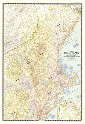
Explore the rich history and vibrant modern sites of Maine, Vermont, New Hampshire, Massachusetts, Connecticut, Rhode Island, and neighboring states with "A Map of New England with Descriptive Notes." Published in June 1955, this map of New England contains an abundance of historical notes overlaying the fine cartography National Geographic is known for.

The 1955 Map of New England with Descriptive notes map features:
• Notes about historical sites and points of interest
• Inset of Northern Maine
• Expressways, roads, railways, canals, and airports
• Mountains, passes, rivers, and lakes
• Geographical equivalents

Coverage Area: Maine, New Hampshire, Vermont, Massachusetts, Connecticut, Rhode Island, eastern New York, northern New Jersey, northeastern Pennsylvania

More Product Details

This map requires 7 business days to print and laminate prior to shipping.

Appearing in the June 1955 issue of the National Geographic Magazine, this Map of New England with Descriptive Notes map has been reproduced from its original cartography in order to bring to life a beautiful poster previously only seen in National Geographic Magazine. This reproduction holds true to the high standards that National Geographic Maps are known for.

Perfect for home, office or classroom, this map also makes a great gift. Map collectors will surely want to add this map to their library.

The Paper version is printed on high quaility semi-gloss paper, perfect for framing.

The Laminated version uses 3mm laminate on both sides for durability, is easy to clean and markable.

From the National Geographic Classic Maps collection, this reproduction is just one of hundreds of titles available here. These maps are Printed on Demand. Sizes are approximate and may vary due to the nature of the trimming and laminating processes.
Shipping Conditions
Maps.com ships to Dometic US only

US FlagThis product can only be shipped to the Domestic U.S.A. (No APO's or PO Boxes)
TimeThis map requires 2 business days to print and laminate prior to shipping.