SHOP BY YEAR :: FOR OFFICE :: FOR CLASSROOM :: GIFT IDEAS :: CUSTOMER SERVICE

Mid Atlantic States Map: Beckoning Land Beside Bay and Sea 1976
Issue: October 1976
More Views
Enlarge Image
ZoomClick here to zoom!
Purchase Product :
Please select map format:
Laminated   
22.5" x 35" - $39.95
Laminated-w/Plastic Rails  (What are rails?)
22.5" x 35" - $51.95
Paper
22.5" x 35" - $29.95
Wallzilla Adhesive Format
22.5" x 35" - $59.95
Product Highlights
Mid Atlantic States Map: Beckoning Land Beside Bay and Sea 1976
Item#: X NGC 101976b

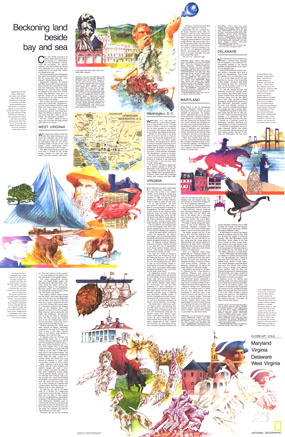
Published in October 1976, this map/travel poster entitled "Maryland, Virginia, Delaware, West Virginia: Beckoning Land Beside Bay and Sea" is half of a two-piece set in the "Close-Up: U.S.A." series, a companion to the Mid-Atlantic States map. With an overview of the beautiful natural features and historical sites to be found in each of the four states and in Washington, D.C., this work is a wonderful guide for travelers.

The 1976 Maryland, Virginia, Delaware, West Virginia: Beckoning Land Beside Bay and Sea map features:
• Map of downtown Washington, D.C.
• An introduction to the region
• Historical and travel information on each of the five states
• Colorful illustrations

Coverage Area: Maryland, Delaware, District of Columbia, Virginia, West Virginia

More Product Details

This map requires 7 business days to print and laminate prior to shipping.

Appearing in the October 1976 issue of the National Geographic Magazine, this Maryland, Virginia, Delaware, West Virginia: Beckoning Land Beside Bay and Sea map has been reproduced from its original cartography in order to bring to life a beautiful poster previously only seen in National Geographic Magazine. This reproduction holds true to the high standards that National Geographic Maps are known for.

Perfect for home, office or classroom, this map also makes a great gift. Map collectors will surely want to add this map to their library.

The Paper version is printed on high quaility semi-gloss paper, perfect for framing.

The Laminated version uses 3mm laminate on both sides for durability, is easy to clean and markable.

From the National Geographic Classic Maps collection, this reproduction is just one of hundreds of titles available here. These maps are Printed on Demand. Sizes are approximate and may vary due to the nature of the trimming and laminating processes.
Shipping Conditions
Maps.com ships to Dometic US only

US FlagThis product can only be shipped to the Domestic U.S.A. (No APO's or PO Boxes)
TimeThis map requires 2 business days to print and laminate prior to shipping.