SHOP BY YEAR :: FOR OFFICE :: FOR CLASSROOM :: GIFT IDEAS :: CUSTOMER SERVICE

Classical Lands Of The Mediterranean Map 1940
Issue: March 1940
More Views
Enlarge Image
ZoomClick here to zoom!
Purchase Product :
Please select map format:
Laminated   
35" x 25.5" - $39.95
Laminated-w/Plastic Rails  (What are rails?)
35" x 25.5" - $51.95
Paper
35" x 25.5" - $29.95
Wallzilla Adhesive Format
35" x 25.5" - $59.95
Product Highlights
Classical Lands Of The Mediterranean Map 1940
Item#: X NGC 031940

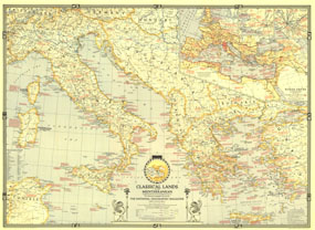
This map was published in March 1940 in an issue of National Geographic entirely devoted to the Classical Lands of the Mediterranean. An abundance of historical notes and detailed inset maps of ancient Athens, ancient Rome, and the Roman Empire illustrate the rich history of the region. This educational map also features an attractive border showing the twelve signs of the zodiac.

The 1940 Classical Lands of the Mediterranean map features:
• Inset map of the Roman Empire at its greatest extent with roads, walls, and Mediterranean settlements before the rise of Rome
• Greek mythological characters and their Roman equivalents
• Inset maps of ancient Athens, ancient Rome, and the world of Homer
• Historical notes
• Capitals, selected cities, ruins, and battle sites
• Railways and canals
• Mountain relief, passes, rivers, lakes, areas subject to inundation, swamps, wadies, glaciers, and desert

Coverage Area: Italy, Greece, Corsica, Tunisia, Yugoslavia, Albania, Bulgaria, western Turkey

More Product Details

This map requires 7 business days to print and laminate prior to shipping.

Appearing in the March 1940 issue of the National Geographic Magazine, this Classical Lands Of The Mediterranean map has been reproduced from its original cartography in order to bring to life a beautiful poster previously only seen in National Geographic Magazine. This reproduction holds true to the high standards that National Geographic Maps are known for.

Perfect for home, office or classroom, this map also makes a great gift. Map collectors will surely want to add this map to their library.

The Paper version is printed on high quaility semi-gloss paper, perfect for framing.

The Laminated version uses 3mm laminate on both sides for durability, is easy to clean and markable.

From the National Geographic Classic Maps collection, this reproduction is just one of hundreds of titles available here. These maps are Printed on Demand. Sizes are approximate and may vary due to the nature of the trimming and laminating processes.
Shipping Conditions
Maps.com ships to Dometic US only

US FlagThis product can only be shipped to the Domestic U.S.A. (No APO's or PO Boxes)
TimeThis map requires 2 business days to print and laminate prior to shipping.