SHOP BY YEAR :: FOR OFFICE :: FOR CLASSROOM :: GIFT IDEAS :: CUSTOMER SERVICE

Pacific Ocean Map 1936
Issue: December 1936
More Views
Enlarge Image
ZoomClick here to zoom!
Purchase Product :
Please select map format:
Laminated   
38" x 31" - $59.95
Laminated-w/Plastic Rails  (What are rails?)
38" x 31" - $76.95
Paper
38" x 31" - $49.95
Wallzilla Adhesive Format
38" x 31" - $89.95
Product Highlights
Pacific Ocean Map 1936
Item#: X NGC 121936

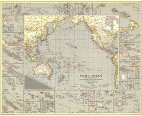
Explore the islands and coastlines of the Pacific with this thorough map of the region. With inset maps of dozens of islands and instructive details such as ship routes, naval bases, time zone boundaries and more, this map makes a wonderful collectors piece. Published in December 1936, it accompanied an article entitled "Flying the Pacific."

The 1936 Pacific Ocean map features:
• Border maps of dozens of islands including the Bismarck Archipelago, the Solomon Islands, Tonga, Fiji, the Hawaiian Islands, the Galapagos Islands, and the Aleutian Islands
• Naval bases
• Time zone boundaries and clocks showing the time when it is midnight at Greenwich
• Airline distances in statute miles
• Thousands of place names including capitals, cities, and towns
• Principal ship routes and railways
• Geographical features including mountains, swampy regions, glaciers, reefs and sand

Coverage Area: Pacific Ocean, North America, western South America, eastern Asia, Australia, New Zealand

More Product Details

This map requires 7 business days to print and laminate prior to shipping.

Appearing in the December 1936 issue of the National Geographic Magazine, this Pacific Ocean map has been reproduced from its original cartography in order to bring to life a beautiful poster previously only seen in National Geographic Magazine. This reproduction holds true to the high standards that National Geographic Maps are known for.

Perfect for home, office or classroom, this map also makes a great gift. Map collectors will surely want to add this map to their library.

The Paper version is printed on high quaility semi-gloss paper, perfect for framing.

The Laminated version uses 3mm laminate on both sides for durability, is easy to clean and markable.

From the National Geographic Classic Maps collection, this reproduction is just one of hundreds of titles available here. These maps are Printed on Demand. Sizes are approximate and may vary due to the nature of the trimming and laminating processes.
Shipping Conditions
Maps.com ships to Dometic US only

US FlagThis product can only be shipped to the Domestic U.S.A. (No APO's or PO Boxes)
TimeThis map requires 2 business days to print and laminate prior to shipping.