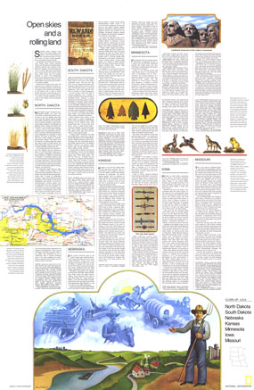
The "North Dakota, South Dakota, Nebraska, Kansas, Minnesota, Iowa, Missouri: Open Skies and Rolling Land" travel poster is a companion to the map of the North Central States, published in March 1974. Part of the "Close-up: U.S.A." series, this map hightlights the diverse landmarks and landscapes to be found in the region including agricultural settings, Indian reservations, frontier forts, national forests, and scenic lakes and rivers. The 1974 North Dakota, South Dakota, Nebraska, Kansas, Minnesota, Iowa, Missouri: Open Skies and Rolling Land map features:
• Inset of Lake Sakakawea and Garrison Dam in South Dakota
• Landmark Treasures of the Nation's Heartland highlighted
• An introduction to the region
• A travel article on each state
• Colorful illustrations
Coverage Area: North Dakota, South Dakota, Nebraska, Kansas, Minnesota, Iowa, Missouri
|


 Click here to zoom!
