SHOP BY YEAR :: FOR OFFICE :: FOR CLASSROOM :: GIFT IDEAS :: CUSTOMER SERVICE

Prairie Provinces Map Side 1 1994
Issue: December 1994
More Views
Enlarge Image
ZoomClick here to zoom!
Purchase Product :
Please select map format:
Laminated   
27" x 20.5" - $39.95
Laminated-w/Plastic Rails  (What are rails?)
27" x 20.5" - $51.95
Paper
27" x 20.5" - $29.95
Wallzilla Adhesive Format
27" x 20.5" - $59.95
Product Highlights
Prairie Provinces Map Side 1 1994
Item#: X NGC 121994a

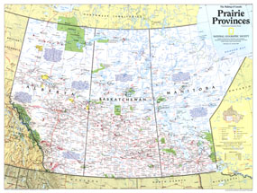
A land of sweeping prairies and abundant wildlife, Alberta, Saskatchewan and Manitoba make up Canada's agricultural heartland. Part of the "Making of Canada" series, this map of the Prairie Provinces is half of a two-map set published in December 1994 which accompanied the article "Canada's Highway of Steel."

The 1994 Prairie Provinces map Side 1 features:
• Historical notes about the region
• Capitals, cities, and towns
• Indian reserves, national parks, provincial parks, and wildlife areas
• Limited-access highway, roads, passenger railroads, airports, and scheduled air or seaplane service
• Mountains, rivers, lakes, swamps, and glaciers or ice fields
• Location map and abbreviations

Coverage Area: Alberta, Saskatchewa, Manitoba

More Product Details

This map requires 7 business days to print and laminate prior to shipping.

Appearing in the December 1994 issue of the National Geographic Magazine, this Prairie Provinces map has been reproduced from its original cartography in order to bring to life a beautiful poster previously only seen in National Geographic Magazine. This reproduction holds true to the high standards that National Geographic Maps are known for.

Perfect for home, office or classroom, this map also makes a great gift. Map collectors will surely want to add this map to their library.

The Paper version is printed on high quaility semi-gloss paper, perfect for framing.

The Laminated version uses 3mm laminate on both sides for durability, is easy to clean and markable.

From the National Geographic Classic Maps collection, this reproduction is just one of hundreds of titles available here. These maps are Printed on Demand. Sizes are approximate and may vary due to the nature of the trimming and laminating processes.
Shipping Conditions
Maps.com ships to Dometic US only

US FlagThis product can only be shipped to the Domestic U.S.A. (No APO's or PO Boxes)
TimeThis map requires 2 business days to print and laminate prior to shipping.